Curriculum Design Tool
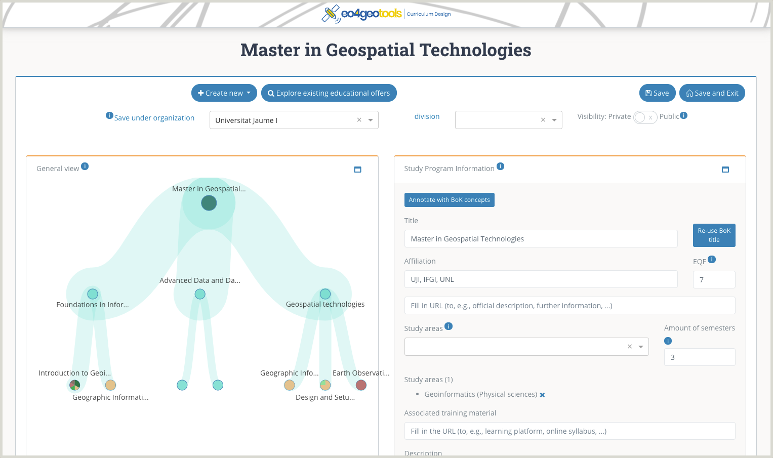
The Curriculum Design Tool (CDT) allows users to create, edit and find educational offers in the field of Earth Observation and Geographic Information. Educational offers may benefit from the EO4GEO BoK, by re-using descriptions of related BoK concepts and link specific EO/GI BoK concepts and skills.
The modularity of the tool allows to create educational offers at different levels of granularity, from an entire study program to a single lecture or lesson. This allows its use by a broad range of educational offers by various providers, ranging from academia programs to high school curricula or VET trainings. It also allows re-use of educational offers, by duplicating or promoting existing offers and adapting them to the user’s needs.
Among others, the tool is populated with a list of innovative educational offers, created by EO4GEO partners, and will contain training offers in the future- The European Skills/Competences and Occupation (ESCO) classification is used for the inclusion of transversal skills.
To register or not to register? All tools are available for viewing and exploring as an anonymous user. However, to create and save your own content, you need to register and join (or create) your organization. You can register in the Login page, either by signing up with a valid email address, or by using your existing gmail account. You join or create your organization in the Organization page from the dropdown menu. User accounts and organizations are shared between all the tools, which means you can use the same user and password for all the tools.
Your created content can be made publicly (for everybody) or privately (only for organization members) visible.
Target audiences: Academia, training providers.
Examples of use:
- A training provider creates a course addressed to the EO/GI community.
- A university design a new study programme about Copernicus downstream services.
Interested?
The EO4GEO BoK tools were developed by the Geospatial Technologies Research Group (GEOTEC) from the University Jaume I, Castellón (Spain) in the context of the EO4GEO project. For more information, CONTACT US.
User support
User guide (PDF 1.37MB)
Video
Access the application
Subscribe to our newsletter
Keep yourself updated, receive SPACE4GEO Alliance news and info on new opportunities.
Join the SPACE4GEO Alliance
Be part of the SPACE4GEO Alliance and let’s discuss and work together on the supply and demand of skills in the EO/GIS sector. Stakeholders in the EO, GIS and Skills sectors are more than welcome!
Join a Network pooling together expertise from academia, VET providers, company, public institutions, research centres and sectoral associations with the common goal of fostering skills development in the space and geoinformation downstream sector.
